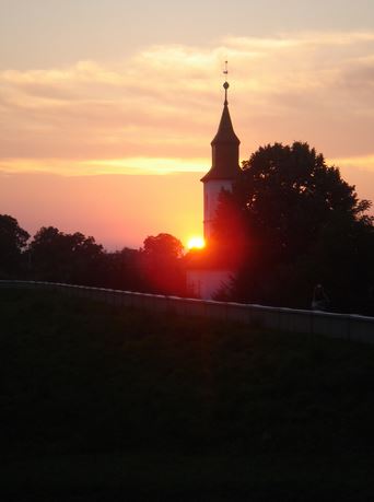
The name Tivadar was first mentioned in the papal decimal-numbers in the year 1333. In the 19th century it was a flourishing settlement. In 1428 the Petneházy-family, in 1435 the landlord of the Jedi-family lived in the village. In 1551 the Russian Demeter-family acquired the settlement as a royal donation.
In 1566 militant troops of the Turk-tartars destroyed the settlement.
It was Miklós Zoly, the military leader of Transylvania, who acquired the estate in exchange in 1599. Between 1600 and 1676 various owners were registered.
In 1800 the families Kölcsey, Szarka, Vincze, Gacsályi and Matolcsi owned a larger estate in the village.
The Theiß and its marshy swamps are part of the protected national park Szatmár-Bereg. The village is one of the stop-overs of the international Tisza-tour. The settlement is one of the stations of the plume-road.
The Theiß (hung. Tisza) is the longest tributary of the Danube (after the Save, with an average of 813 m³/s of water-flow; ahead of the Drau and Inn, it is second richest water-wise); it is also the second-largest river of Hungary and Serbia and is / was (according to the Meyer encyclopedia of 1888) the richest European river as to fish. After it the end-neolithic culture was named.
The source of the Theiß is in the woody Carpathian regions and it is a confluence of the white and black Tisza north of the Ukraniane town of Rachiw. Initially, it cuts its way through narrow mountain-valleys and then turns west and southwards via Sighetu and Marmatiei to Chust after having joined the Iza, the Tereswa, Tereblja and Rika.
So far the Tisza is pure and fast-flowing, but in the plains it becomes sluggish and marshy. On its way the Borschawa, Túr and Szamos flow into the Theiss, which then turns southwest from Tschop to Szolnok via Tokaj. It continues southwest, passing Csongrád and Szeged, until it reaches the Danube-delta (beneath Novi Sad) in today’s Vojodina, after having flowed parallel to the Danube in an average distance of 90kms.
The riverbanks are mostly flat and, due to the frequent floods, swampy. The width of the river is between 160 and 320 m. It becomes navigable near Sziget, for larger vessels at the mouth of the Hernád. Steamboats, which used to frequent the river up to Tokaj, can use the river from Szolnok, from where they transport
the same heavy cargo as on the Danube. The Bacser- or Franzenscanal links it with the Danube, the Begacanal with the Temesch river.
For some time the regulation of the Theiß, the draining of the marshy river-banks as well as the protection of the riverside from flooding has been going on; however, as a consequence of the incomplete execution of the project, lower-lying regions have been negatively affected. All in all, the length of the Theiß with all its meanders is 1308 km, its direct distance to the source is only 467 km. The surrounding area comprises 146.500 km². Due to its very low gradient, the river is quite sluggish. From Namény to the mouth of the river its water-level is only about 40 m lower. Floods from the Danube, which is twice as fast, have a dam-like effect on the Theiß upstream.